P—56 · Geometric comparison, not a site allocation
50,000-person settlement scenarios
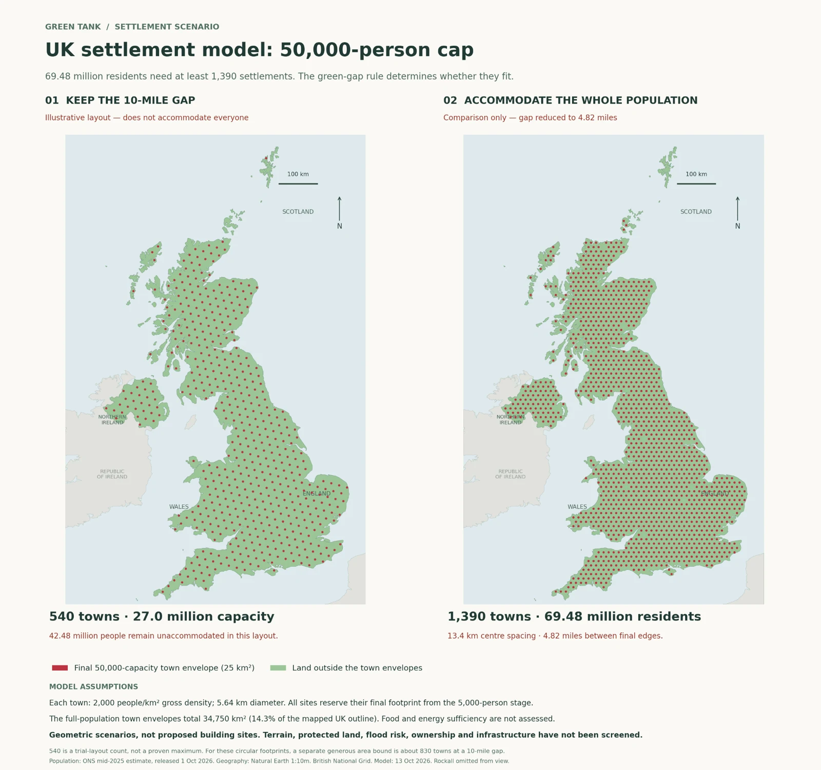
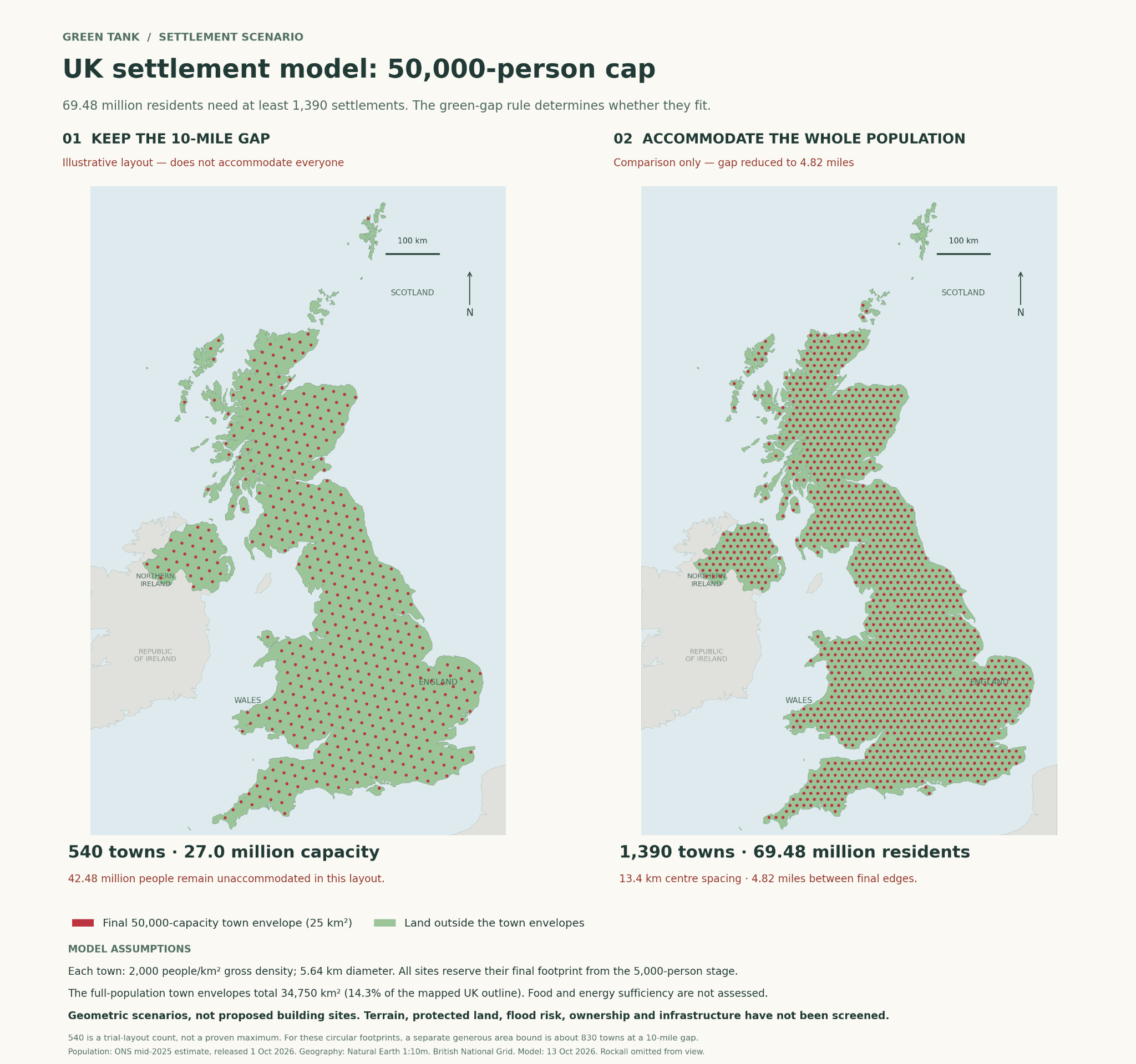
The supplied model uses a population baseline of 69,483,900, circular settlement envelopes of 25 km² and a gross density of 2,000 people per km². Compare what changes when the edge-to-edge gap changes.
Strict ten-mile edge gap
540 trial settlements
The illustrated layout has capacity for 27 million people, leaving approximately 42.48 million outside it. This is a trial output, not a proven maximum. Under the stated geometry, the model’s generous upper bound is still below the whole-population requirement.
Whole-population comparison
1,390 settlements
This illustration changes the spacing to 13.4 km between centres, giving an edge gap of about 7.76 km, or 4.82 miles. It does not preserve the original ten-mile green gap and does not prove the largest feasible alternative gap.